sager logo
Discover SAGER

Get complete tailored End-to-end solutions enabling more safe, efficient, and effective flight operations strengthening your business with aerial intelligence across the entire project lifecycle

sager
optimized mapping and surveying services
/ Home / Mapping & Surveying
mapping
red-rectangle

Mapping and Surveying Solutions

optimized mapping and surveying services

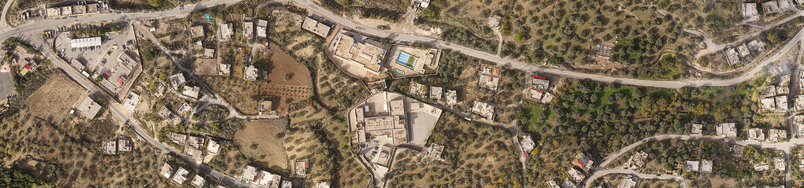
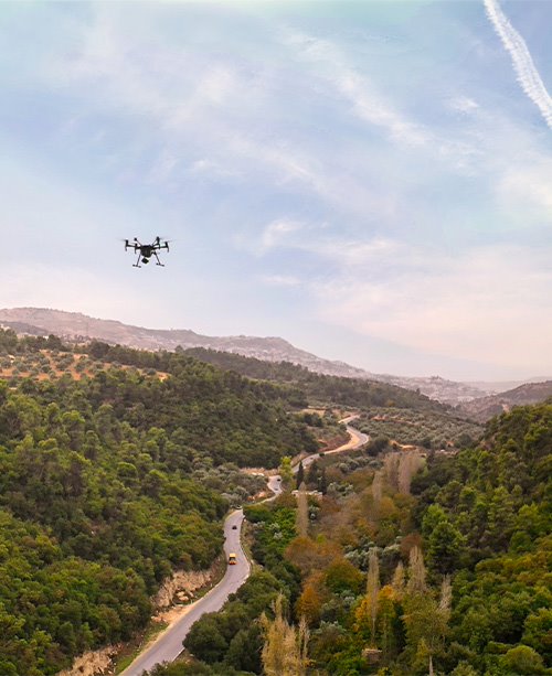
Sager delivers optimized mapping and surveying services using state-of-the-art drone technology designed to collect high-quality data across even the most inaccessible and large-scale site – in a fraction of the time.

In fact, our drone surveys deliver a 75-80% faster completion rate than terrestrial measurement while providing you unmatched accuracy and resolution. Our data can be used to produce valuable assets including orthomosaic photos, detailed visual inspections of areas, and topographic maps.

about us explore
How it works?
Our surveying and mapping services are powered by cutting-edge drone and sensor technologies, such as special RGB cameras that employ photogrammetry technology, multispectral, thermal, and LiDAR sensors. After data capture is complete, we then implement advanced software and AI engines to process data into accessible, high-value assets for more agile decision-making.
Outputs
red-rectangle

surveying Outputs

optimized mapping and surveying services

2D Orthomosaic Drone Maps
A 2D orthomosaic is a high-resolution digital reconstruction made up of hundreds or thousands of photographs taken by a drone to produce centimeter-level georeferenced maps. These maps and images provide a realistic perspective, allowing for quick decision-making and analysis of a project’s progress.
3D Mesh Maps
A 3D mesh map uses point cloud data and evolves them into a three-dimensional mesh using overlapping imagery to displays 3D objects such as buildings, trees, and elevation information. This model is particularly valuable for visual inspection, as well as tracking and monitoring project progress.
3D Point Clouds
The survey area or object is digitally represented in a point cloud dataset which has hundreds of points representing a specific geometric coordinate. They work together to create a fully realized 3D model – the more points collected, the richer the model. Point clouds can provide a variety of information, including observations and measurements regarding an object’s depth, elevation, geometry, and spatial position.
Digital Elevation Surface Models and Digital Terrain Models
Using both LiDAR and photogrammetry, the Digital Surface Model (DSM) and Digital Terrain Models (DTM) create an accurate reconstruction of the earth’s surface. Each data product delivers different elevation values based on different methodologies – DSM portrays the earth’s surface and all objects on it, whereas DTM represents the bare-Earth surface, excluding all natural and built features
Applications
red-rectangle

APPLICATIONS AND ANALYTICS

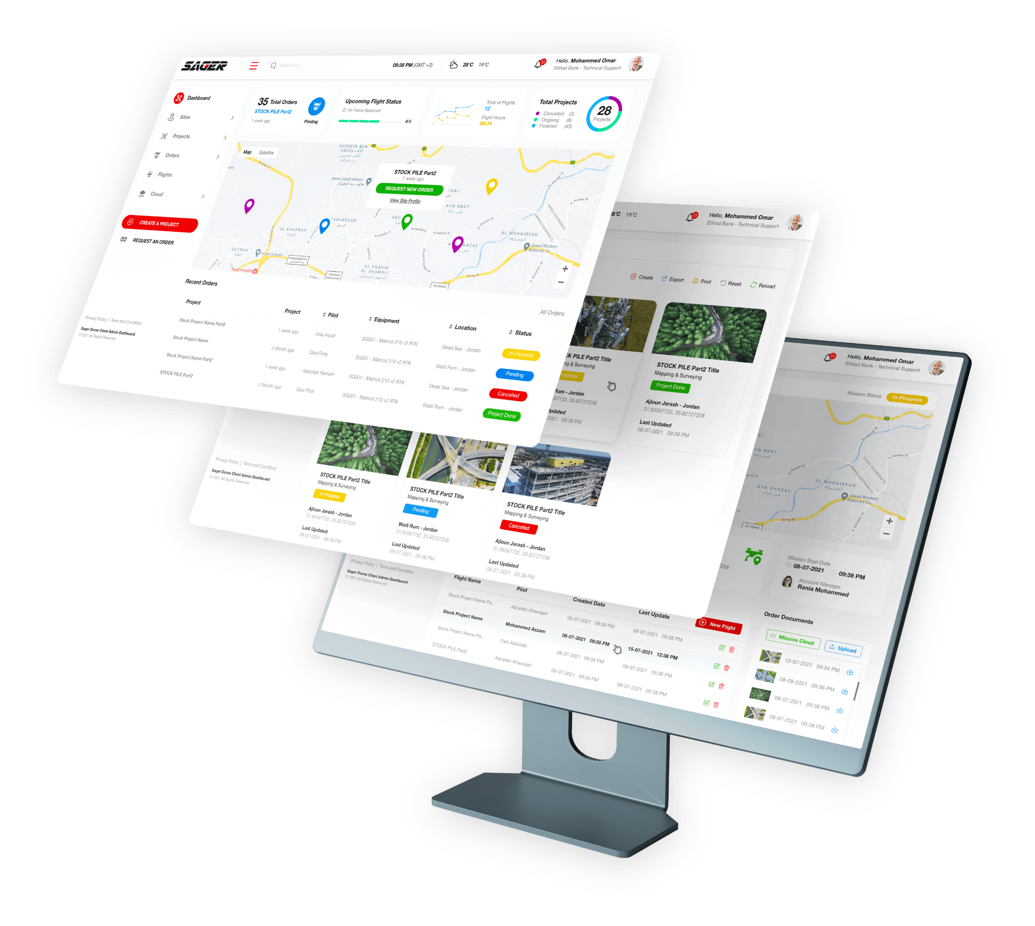
GET REPORTING AND INSIGHTS FROM YOUR DRONE DATA

Efficiently manage assets and infrastructure. Sager’s platform makes it easy to convert aerial data into high-resolution digital models and business intelligence

Mining & Aggregate Assessments
Volumetric analysis of aggregates and stockpiles by UAV is now a standard practice. Besides the advantage of greater speed and accuracy, UAVs can easily reach areas that are difficult or dangerous for land surveyors to access, providing our clients extra protection against unnecessary liability and risk.
Urban Planning & Architecture
Aerial mapping services streamline the management and monitoring of development projects while aiding in the identification and analyzation of social and environmental concerns. As a result, both frontier development of new areas, or re-development of existing ones can be optimized for speed, cost and efficiency.
Heritage Documentation
Drone technologies help to preserve history through the documentation and digital reconstruction of cultural heritage and achelogical sites in the form of digital twins, which are made using advanced technologies like Photogrammetry and LiDAR Scanning to produce 2D and 3D maps with centimeter-level accuracy.

A single source of truth across your portfolio

Perform a routine, AI-based analysis of your portfolio to identify inventory, detect changes and alert you of anomalies.
drone

REVOLUTIONIZE YOUR INSPECTION PROCESS WITH POWER AND RELIABILITY OF ADVANCED DRONE SOLUTIONS

or just send us your inquiries [email protected]

chat