
DRONE-BASED INSIGHTS ON-DEMAND
Tailored support across the project life cycle
SagerSpace™ provides on-demand, no-logistics access to visual insights across your projects. We’ve automated the entire drone data supply chain, from request to delivery, unlocking previously unseen visual insights and perspectives that help you work more safely, efficiently, and intelligently.
Pre-Construction
Simplify pre-construction site planning and scheduling with 3D models from drone images.
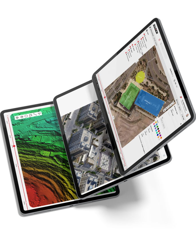
Create an interactive site view including maps, photos, panoramas, and videos.
Reduce cost and time of earthworks using drone surveying.
Perform surveys faster and at a fraction of the cost, while capturing millions of detailed points for:
 Topographic survey Visual records of excavation Cut and fill calculation
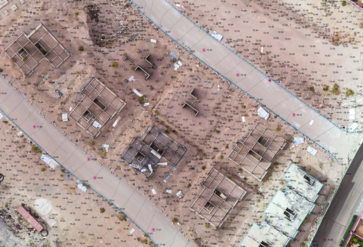
Construction monitoring
Receive on-demand access to visual insights to easily keep project development on track.
Create, document, and share a visual timeline with all stakeholders to keep teams on track.
Detect plan deviations during QA/QC by comparing site reality to pre-construction designs .
Track and communicate progress at any stage.
Verify work with automated cut/fill analysis and side by side comparisons.
.jpeg)
Post-Construction
Get the analytics and transparency insights needed to win more bids and effectively manage and coordinate on future projects.
Document your entire job site safely using aerial & ground imagery.
Improve coordination with your team and subcontractors using a visual record of site conditions.
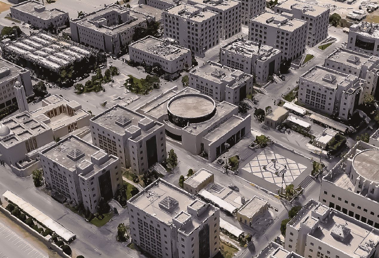
Increase trust with your clients by sharing an accurate digital reconstruction of your job site.
Automatically share SagerSpace maps in your project management solutions.
Powerful tools to manage your portfolio from your desk
Get access to all the features you need to put drones to work automating progress monitoring and collecting valuable insights and data.
Automate site monitoring & perform inventory analysis at scale
Maximize productivity and efficiency with a birds-eye view on the entire project. With access to high-quality data and valuable insights, you’ll be able to effortlessly monitor progress, optimize workflow, and ensure projects are completed on time and under budget.


.svg)
How it works
EASILY DEPLOY DRONES TO CAPTURE INSIGHTS ABOUT YOUR Portfolio.
Site Planning & Mission Generation
Construction sites are imported and missions are auto-generated for volume dispatch and logistics. Each mission is optimized according to the unique specifications and requirements of your site.

How it works
EASILY DEPLOY DRONES TO CAPTURE INSIGHTS ABOUT YOUR Portfolio.
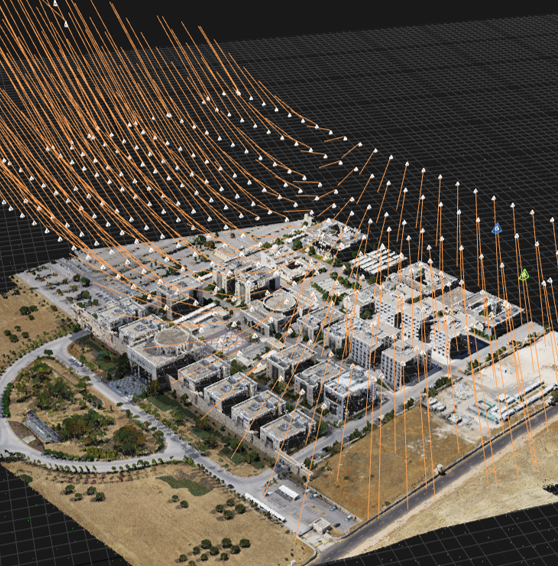
When a request is made, internal or external pilots will be dispatched to coordinate and execute customized flight plans that the drones will autonomously execute to digitize every angle of a site with industry-leading accuracy and precision.

How it works
EASILY DEPLOY DRONES TO CAPTURE INSIGHTS ABOUT YOUR Portfolio.
Data Processing & Modeling
The Hangar Platform will then automatically upload, ingest, and transform the raw data into a highly accurate digital reconstruction of the site.
How it works
EASILY DEPLOY DRONES TO CAPTURE INSIGHTS ABOUT YOUR Portfolio.
Analysis & Reporting
Hangar will perform a detailed analysis, powered by pioneering machine learning and artificial intelligence, and present findings within our viewer, or your system of record.
How it works
EASILY DEPLOY DRONES TO CAPTURE INSIGHTS ABOUT YOUR Portfolio.
Analysis & Reporting
Sager will then perform a detailed component analysis, powered by pioneering machine learning and artificial intelligence, and present insights within our viewer or your system of record.
Unlock Productivity With The Click of a Button
Get access to all the features you need to put drones to work automating inspections and collecting valuable tower insights.

Scroll through the history of your project, from phase 1 to completion.

Provide team members with critical project information, updates, and instructions.

Tag and share data and visual insights to key personnel.

Calculate cut and fill volumes or leverage StockPile reports.

Use built-in tools to calculate area and distance without leaving your desk.
The Hangar Platform offers a range of customized features, designed to simplify and streamline communication, coordination, and implementation across the project lifecycle.
Effortlessly gain real-time visibility across all your sites to document progress, manage teams, and build smarter.
Establish a reliable source of data
Digitize assets
Model structures
Understand tenant inventory
Perform AI-based analytics
Document changes & progress


A CENTRALIZED SOURCE OF INSIGHT ACROSS YOUR PORTFOLIO
Making Construction Faster, More Efficient, and More Intelligent With Drone Solutions
or just send us your inquiries [email protected]
